Tuesday, September 23, 2008

The Demilitarized Zone

2008-09-23

Programm for today:
- drive to Panmunjom at the DMZ (Demilitarized Zone)
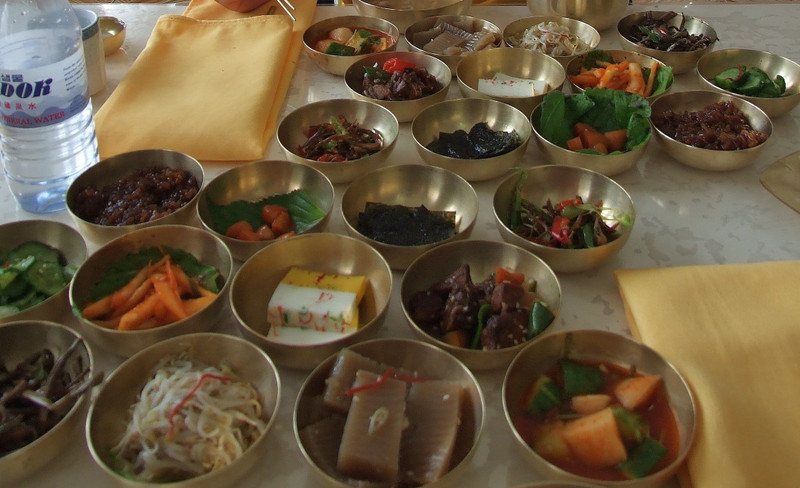
- lunch at Kaesong
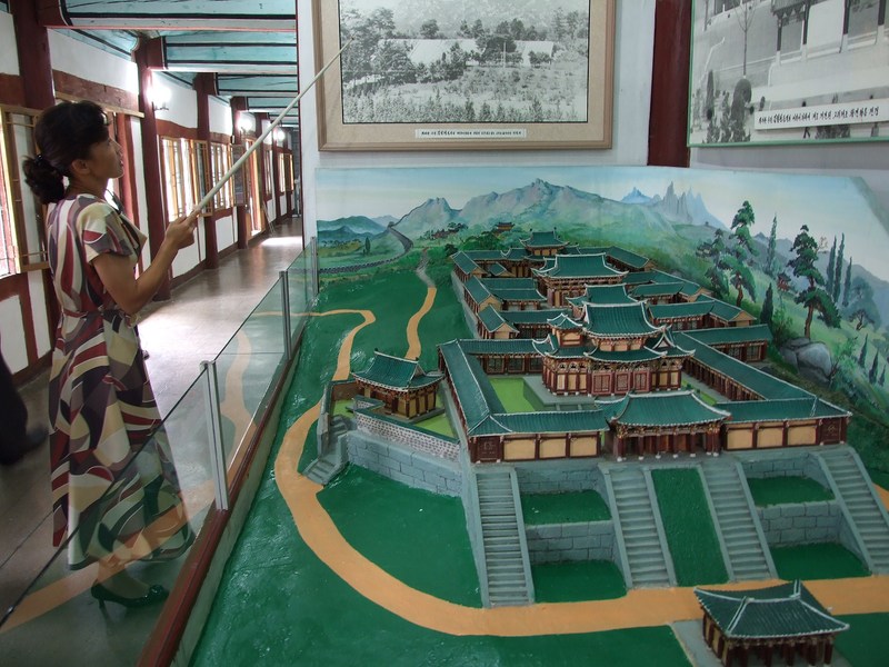
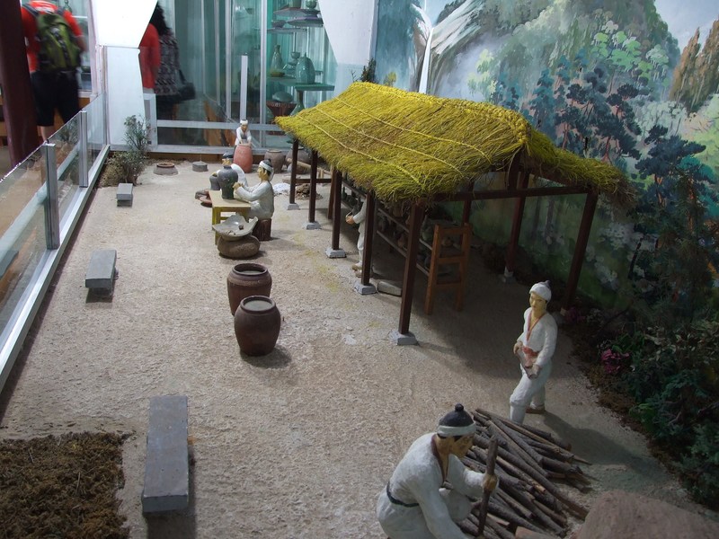
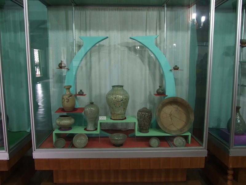
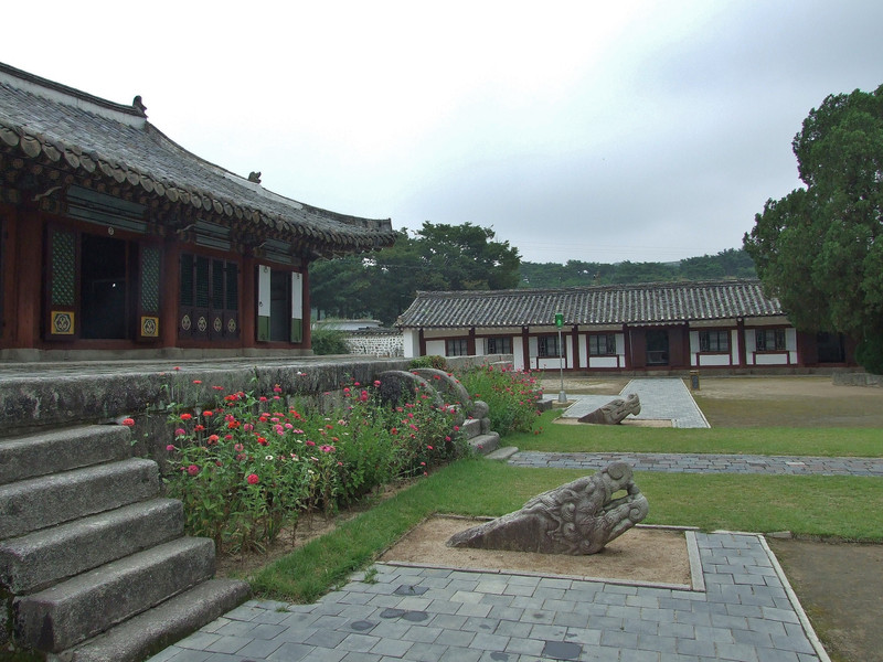
- Koryo-museum at Keasong
- drive back to Pyongyang
- metro museum
- Kim Il Sung's birthplace at Mangyongdae (near Pyongyang)
- dinner at a restaurant in Pyongyang

View from our hotel room in the 21st floor:


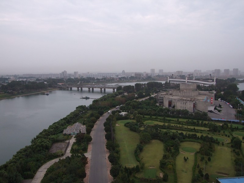
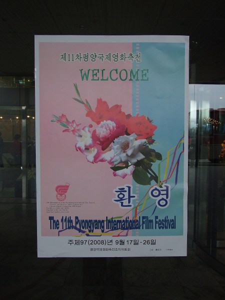
On the island you can see the cinema, where the 11th Pyongyang International Film Festival was taking place during our stay in Pyongyang. Yes, there is indeed an international film festival in Pyongyang:
http://en.wikipedia.org/wiki/Pyongyang_Film_Festival
http://articles.latimes.com/2008/oct/11/world/fg-film11
http://www.gluckman.com/NKFilmFest.html


Due to that our hotel was quite busy at that time; at least I cannot say – unlike I read in other NK-travelogues – , that I had the impression, that the hotel was totally empty and only maybe 3 of 40 floors were open…
Especially in the morning there were lot's of people in the hotel lobby and also relatively long waiting times at the elevantors were not rare. And I had the impression, that also many North Koreans (high officials, of course) stayed at the hotel (alltough on other floors)… or were all of them guides for the foreigners? (our guides stayed at the hotel too during our trip).
Once while waiting for the guides in the lobby I also small-talked with two Germans, who were presenting a film at the festival.

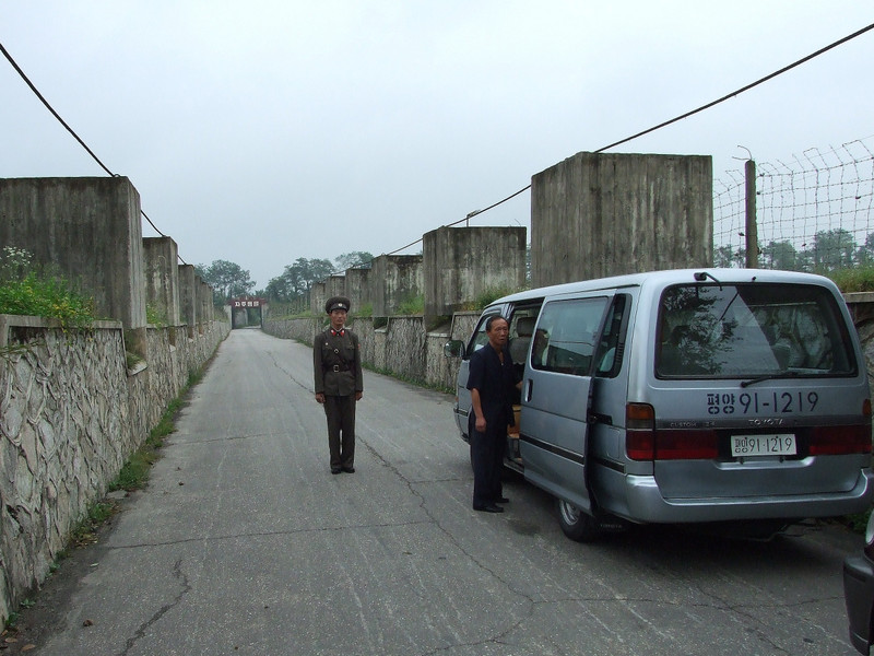
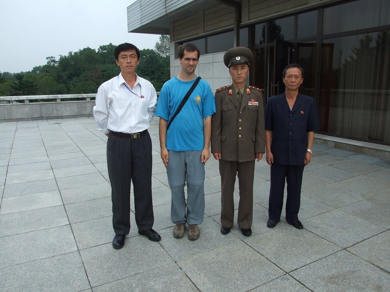
We left for Panmunjom 30 minutes later than planned. The reason was, that our German speaking guide for the 1st two days got ill, and the "new" one who replaced him for the remaining two days had to accompany some tourists to the airport in the morning before meeting us.

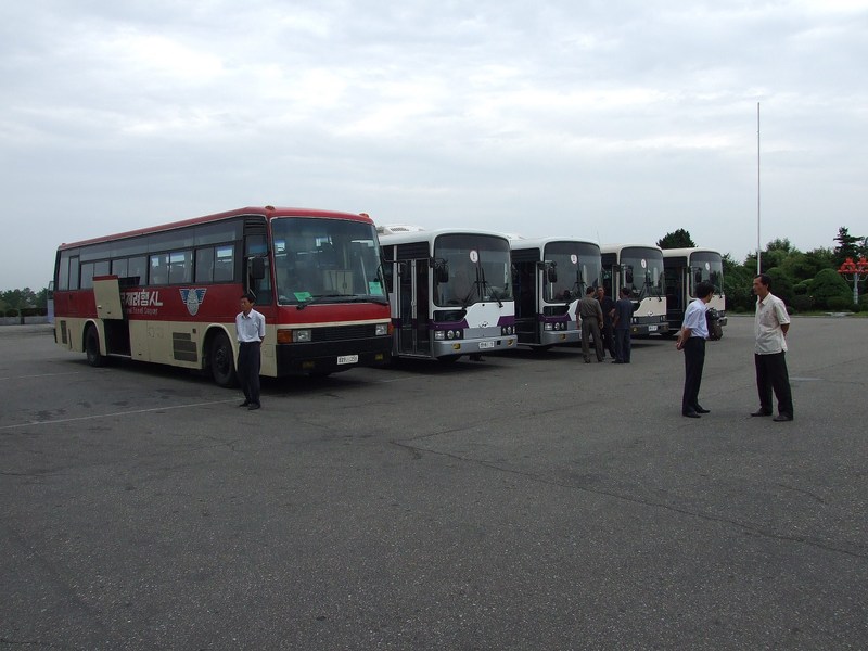
During the waiting time Oliver and I did an "on-the-spot-guidance" at the car park in fron the hotel. Several KITC tour-busses were waiting for the tourist groups.


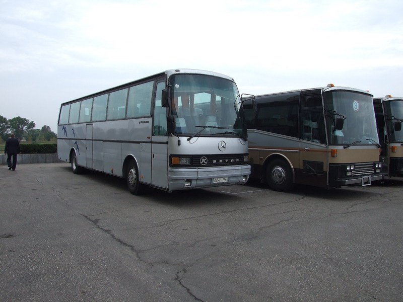
Also one "Kässbohrer Setra" bus was amongst the buses…


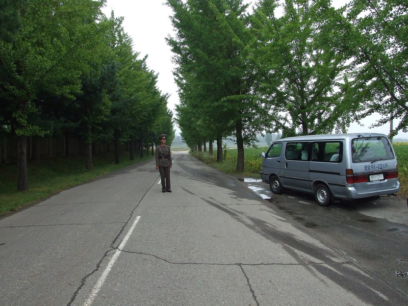
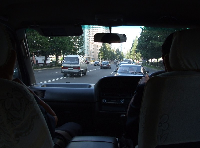
The drive to the DMZ took about 2 hours. The highway was similar to that to Myohangsan but with more tunnels, as the area was quite hilly.
It was noticeable that we got closer to the border, there were four checkpoints on the way there. But we only had to stop for a few seconds if at all.
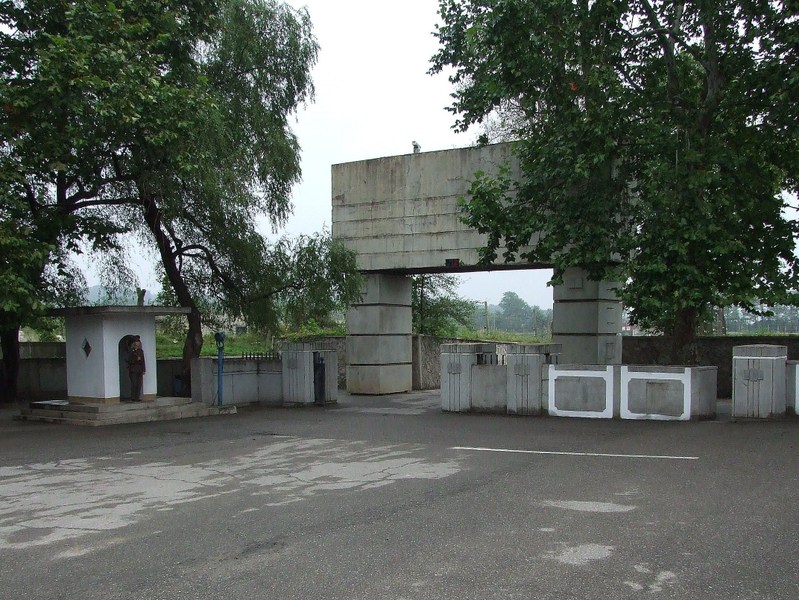
Also concrete columns next to the road were signs of the near border. In an emergency case they would fall down on the road to block the way for tanks from the South...

I have no photos of them, but I found some here:

http://www.4sync.com/web/get/s.dolya/blog/NorthKorea22/20080923_nkorea_521.jpg
http://www.4sync.com/web/get/s.dolya/blog/NorthKorea21/20080923_nkorea_488.jpg

After the highway passes Kaesong it continues for a few more kilometers before it ends abruptly at the beginning of the DMZ. There is a even signpost saying "Seoul, 70 km"...

The DMZ divides North and South Korea. It is 248 km long and about 4 km wide. It is usually impossible to cross the DMZ, but in the previous years tourists coming from South Korea could visit some areas in the North and then crossed the DMZ by bus over newly built roads. Tours were possible to the Kumgang mountain and to Kaesong. See http://en.wikipedia.org/wiki/Kumgang_mountain.
Currently these tours are suspended due to the worsened relationshuip between the North and the South.
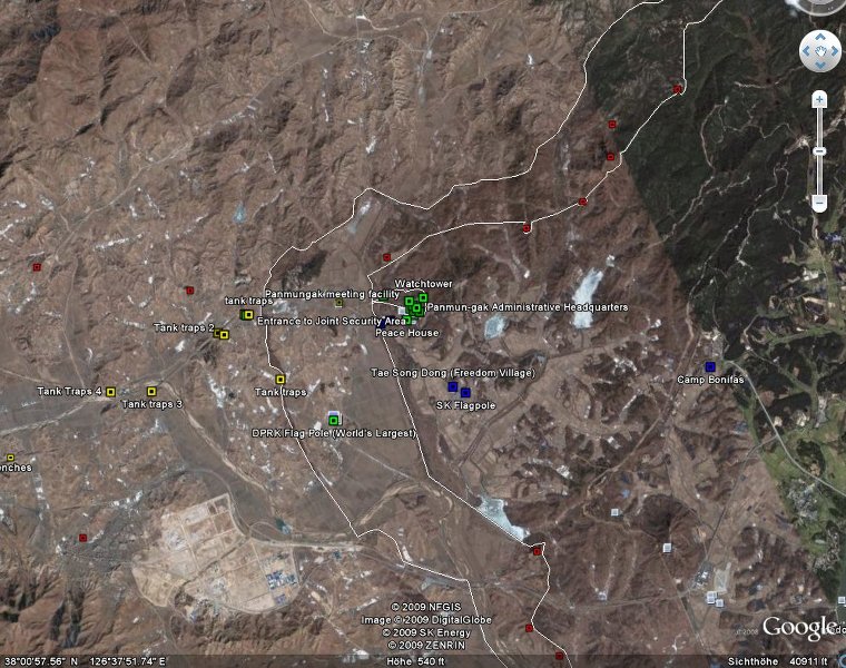
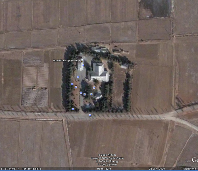
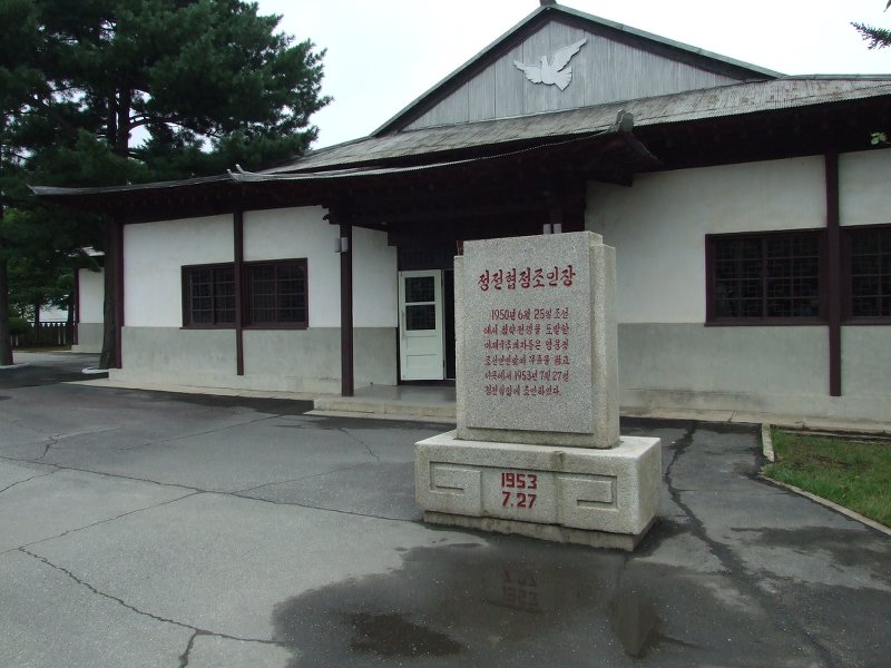
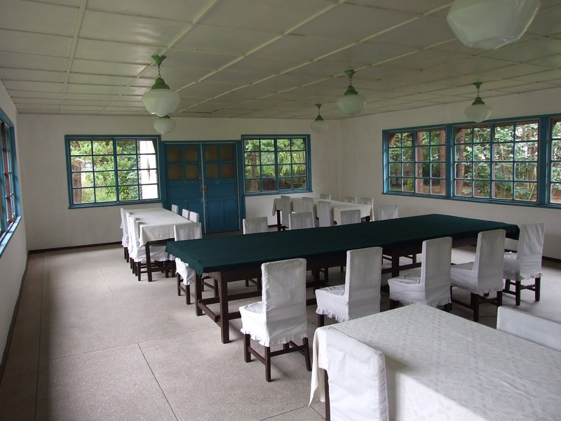
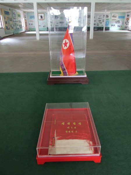
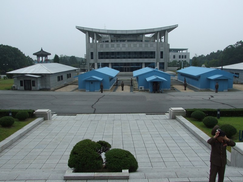
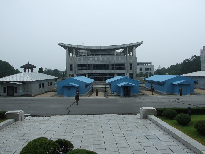
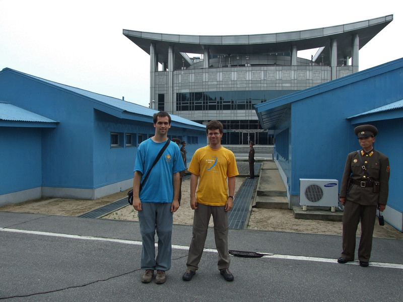
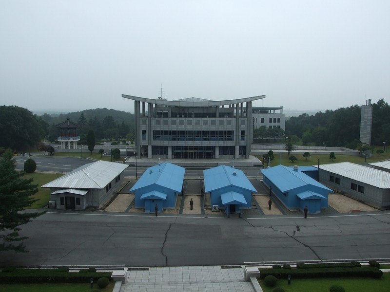
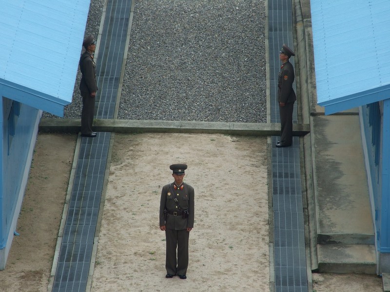
Panmunjom was a village in the middle of the DMZ, where the ceasefire-agreement was signed in 1953. This place today is on the Norther side of the DMZ.
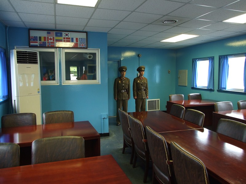
At the demarcation line there is the "Joint Security Area", where today negotiations between the North and the South are held. Tourists can visit the JSA from the North and from the South, but of course it is not possible to cross the border here.

More information:
http://en.wikipedia.org/wiki/Military_Demarcation_Line_(Korea)
http://en.wikipedia.org/wiki/Panmunjom
http://en.wikipedia.org/wiki/Joint_Security_Area

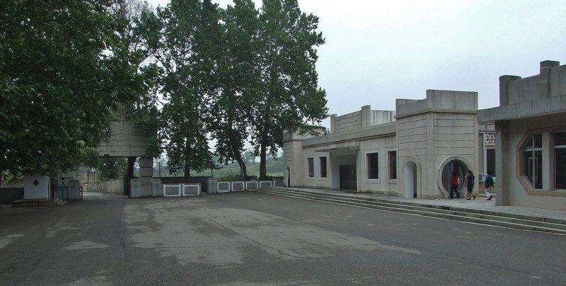
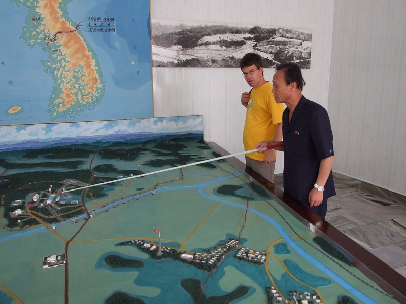
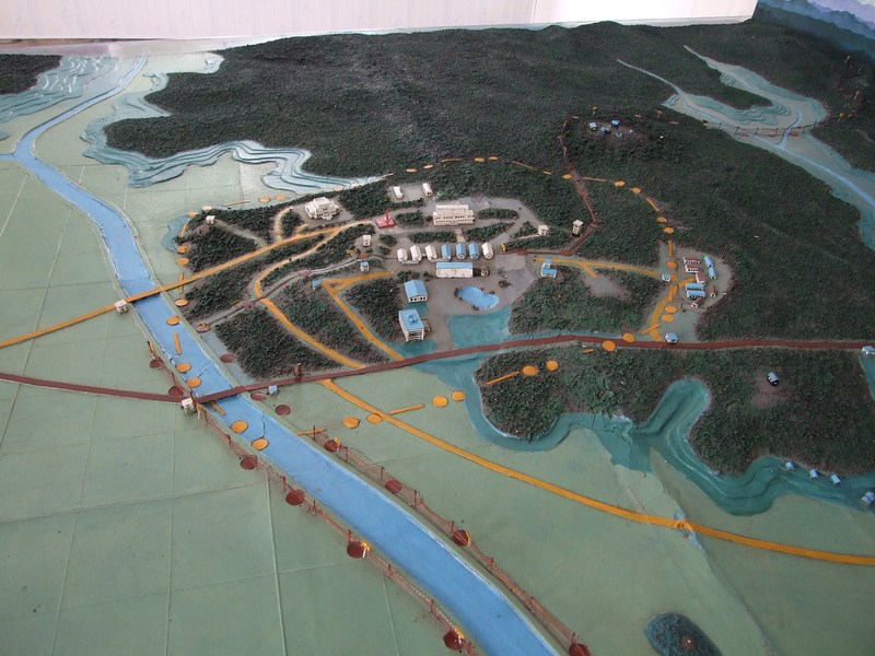
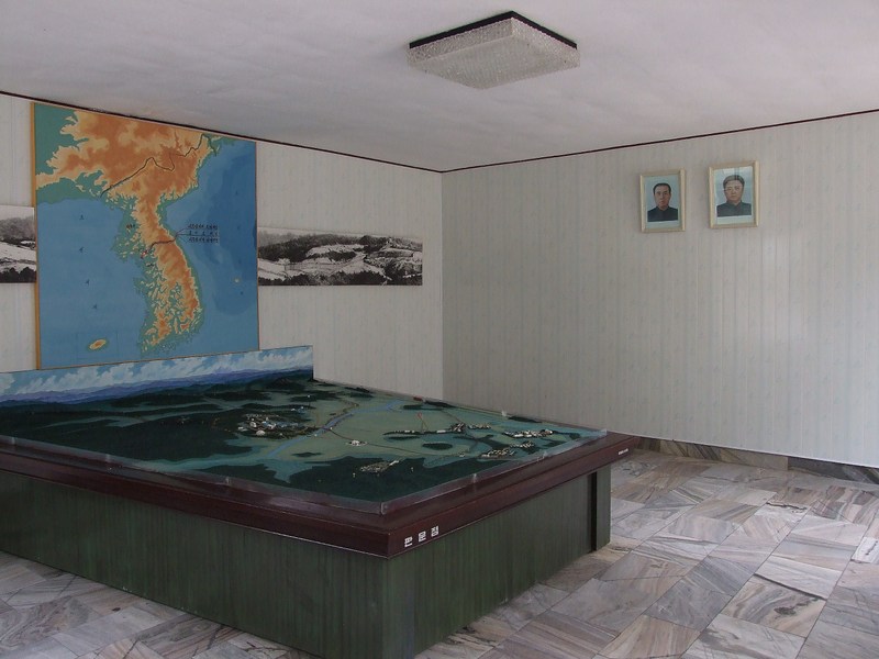
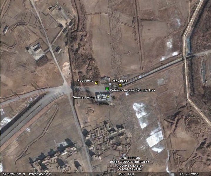
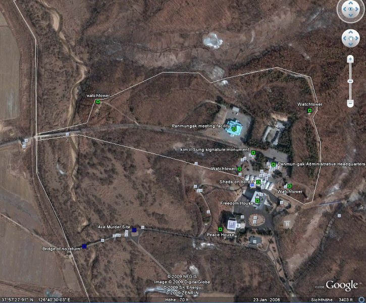
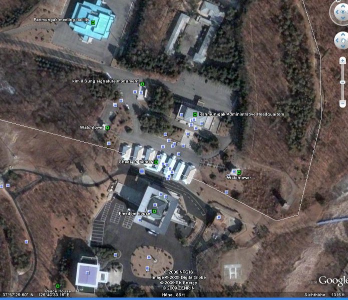
We had a short break at a car park at the entry to the DMZ. In one of the buildings we got a brief introduction into the place.
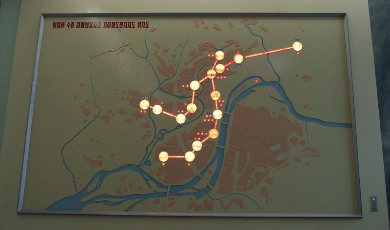


An overview map:


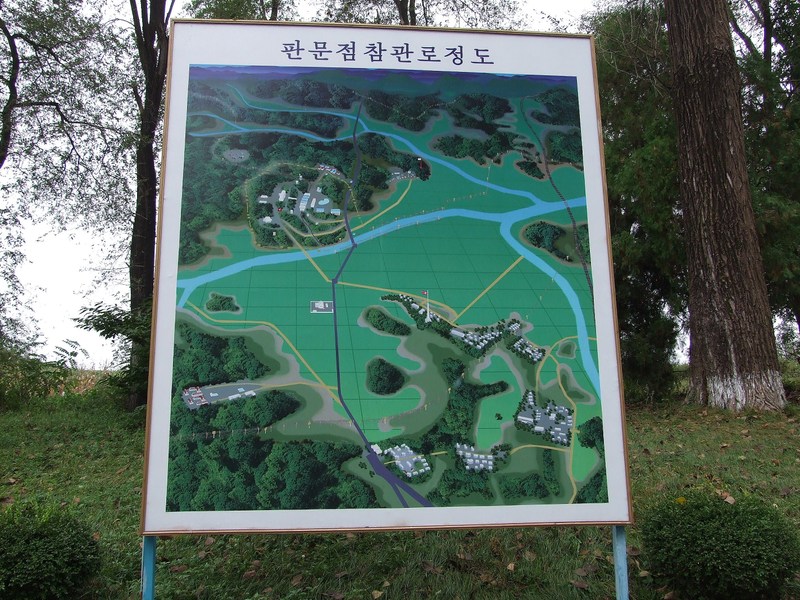
The place where we were is on the bottom, in the middle you see the Joint Security Area (JSA) and between the house, where the cease-fire agreement was signed.


The JSA:


The two Kim's are overlooking everything...


The entry to the DMZ:


Of course it is not possible to drive into the DMZ without being accompanied by a soldier:


Also these concrete cubes are meant to fall down on the road in an emergency case...


Google Earth screenshot of the DMZ:


The white lines mark the center line of the DMZ (the actual border) and the northern boundary. The southern boundary is not marked.
To view this placemarks with Google Earth, download the kmz-file at http://www.nkeconwatch.com/north-korea-uncovered-google-earth/.

The entry to the DMZ:


After about 1,5 km we arrive at the house, where the cease-fire agreement was signed.


Inside the house:


Then we continued to the Joint Security Area.


The JSA actually is located in the southern side of the DMZ, but there is a narrow "Northern" corridor into it:


And here we are:


The buildings in the foreground stand exactly on the border. The big building in the background is already in the South.

Inside the buildings it is possible to cross the border line. The door to the south is closed and guarded by North Korean soldiers.

The typical tourist-photo…


It was a quite strange feeling to be at one moment so close and so far to the "outside" world. Just running between to houses to the south would be no good idea…

After some days as a tourist in North Korea one feels already a little bit caged. You don't have your passport with you and you know that you totally depend on your host country. You can't just go to the station or airport and buy a ticket and leave the country whenever you want.
Of course there are usually no problems for tourists in North Korea and of course I know, that also other every country can prevent you from leaving the country. But here at the DMZ you get remembered, that you are in a closed country.
And also it's hard to believe that basically it is one country on both sides of the DMZ. The seperation already lasts for more than 60 years and the two systems are now totally different. Standing here at the DMZ it's very difficult to imagine how a re-unification of the two Koreas can happen…

However, the genarl atmosphere here was more relaxed then expected. There were no strict security checks (I read that this is different if youz visit the DMZ from the south) and also the fact, that no soldiers on the southern side were visible contribute to the relatively relaxed impression.

We were also not the only tourists there. We also met some tourists from Russia, one of them also published his photos on the web. See http://sergeydolya.livejournal.com/20101.html for his version of the visit to the DMZ (with some excellent photos).
There were however no tourists on the Southern side. We asked the soldier about this (the guide translated), he said, that usually in tourists from the north visit in the morning and tourists from the south in the afternoon.

Overview from the roof of the administration building:


At the Northern end of the DMZ the highway to Pyongyang starts:


The newly built but still "under-used" highway which crosses the DMZ is located some kilometers in the south.
Also the railway line crossing the border was reconstructed. The first train crossed the border in may 2007. See http://www.dailynk.com/english/read.php?cataId=nk03100&num=2086
As far as I know the line has since then been used for freight trains to the Kaesong Instrual Park (see http://en.wikipedia.org/wiki/Kaesong_Industrial_Park), but recently this trains stopped due to the worsened relationship between the North and the South. There were however no regular passenger trains.

We then drove to Kaesong and had lunch at a restaurant.


A group of South Korean nuns on their visit to Kaesong:


I wonder that they were allowed to make a tour to North Korea, as the North Korean regime does all to prevent any Christian influence to their citizen (owining a bible is strictly forbidden).


After lunch we visited the Koryo museum (http://www.northkorea1on1.com/attractions.cfm?aid=kaekoryomus), where ancient relics from the Koryo period (918 AD – 1392 AD) are shown.


As we had some delay in our today's schedule, we had to rush through the interestung museum.

On the way back to Pyongyang we made a break at a highway rest stop, where we bought some mineral water and also the North Korean version of Coca Cola.

North Korean "AutoGrill":


At around 16:15 we were back in Pyongyang – "rush hour" on the roads:


Visit to the metro museum:


The museum is quite interesting, alltough it's mostly about the "on-the-spot-guidances" by Kim Il Sung during the construction period.

The stars on this map show, how many times Kim Il Sung gave "on-the-spot-guidance" to the constrcution of the station concerned:


--


Kim Il Sung's special vehicle to go down to the construction site (using the tunnels which were after completion used for the escalators):


--


An impressive diorama:


Railbus for the "on-the-spot-guidance":
Newer Posts Older Posts Home